DETTIFOSS , SELFOSS, HAFRAGILSFOSS
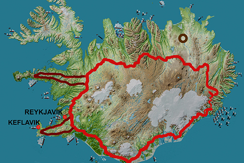 |
| The Ring Road in red and the waterfalls in NE - dark circle. |
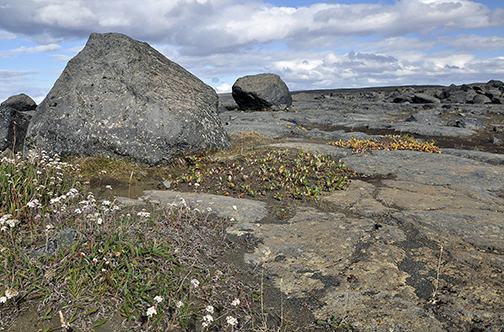
 This plateau reminded us of Sahara desert.
Bare and strewn with sand, gravel and boulders it seemed to lead to nowhere ... but the pylons of rocks served as a reminder of trails leading the traveler to a destination we knew nothing about.
As we drove on the tundra changed too - lichens and mosses disappeared and all was left was bare rock.


But then....there it was! The interpretation sign for Jokulsargljufur National Park!
Until
a few years ago this park used to be its own entity but now it is a
part of the larger Vatnajokull NP to the South of here.
That's where the river - Jökulsá á Fjöllum
(jokul=glacier, a=on, fjöllum=mountains) - originates before making its 200 km way to the North.
 On it, a map the river, the canyon and the faults - meaning -the WATERFALLS!
The red dot on the left meant the parking lot. It was time for a hike!

Whatever vegetation there was, it kept a low profile, crouching on the south-facing sides of the larger boulders.
 It was easy to imagine the glaciers of the past slithering across the plains, their unimaginable mass obliterating the boulders to the meek, flat surfaces.
The shapes of the rocks were also something to study - from the rounded ones to the sharp edged cubes or columns, all that depending on the properties of the rock.
One could spend hours admiring and recording the environment offered by this tortured subarctic plateau.

But the wind and rain prompted us on. Our walk took perhaps half an hour before we got a glimpse of a rainbow.
A waterfall?

The river, peaceful as it made its way through the flat countryside, had been channeled into a series of deep canyons. Roaring mad it hurtled down with and unimaginable force and speed - creating one of the largest and the most powerful waterfalls in all of Europe.

They named it Dettifoss.
The falls could be accessed from either side of the canyon - and if you look closely at the photos you will be able to detect people on the opposite side, some 100 meters away.

Dettifoss drops into the Jökulsárgljúfur canyon, a feature which, along with the Ásbyrgi gorge, appears to have been formed by catastrophic glacial flooding caused by volcanic activity. The volcano in question was possibly Bárðarbunga, which has been identified as posing the risk of a similar event in the future.
It was coincidental that at the time of our Sep 2014 travel, Bárðarbunga awakened underneath the glaciers of Vatnajokul NP, threatening to chew its way up to the surface and disrupt its surroundings once more.

 Same trails that led us to the canyon delivered us safely back to the parking lot. It was from there that we stole the one last look back.
Just then the skies lit up in the pastel colours of rainbow.

Bardabunga volcano calmed down after a few months. But it is still rumbling underneath the solid
wall of Vatnajokul's ice. Dreaming of the future - and when it gets its way it might change this
countryside again.
Only the time will tell.
No comments:
Post a Comment