 Taking photos from an airplane is quite educational.
Just press the lens against the window to make sure that all the glare is gone and that there would be no unwanted selfies via reflection in the glass.
Then it is up to Photoshop or other image enhancing software to bring out the detail.
And at the end call on Google Earth for info and voila!
You will learn that the brown waters mixing up with the Gulf Of Mexico belong to Rio La Antigua. And the one further down is most likely Jamapa River.
Geography and Environmental Studies combined!
The young generation will not blink an eye. Those of us born several decades ago are still quite amazed how much fun the learning has become.

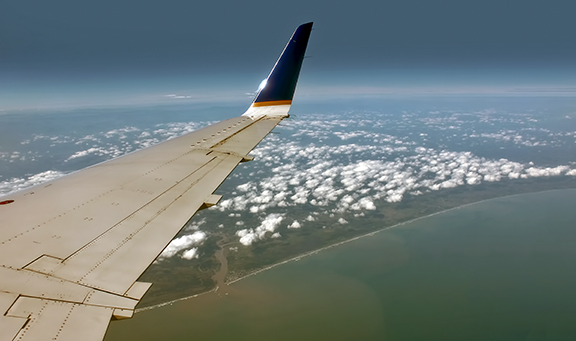
We are arriving to Veracruz.

And the loss of altitude is in direct proportion to the rise of the mighty mountains.

The landscape that stretches from the Gulf of Mexico to the West is a part of the so called Ring of Fire, a chain of volcanoes all along the coast of Pacific Ocean.
And Mexico is slim enough to have a substantial portion of its area covered by these large and only "dreaming" fire-mountains.
 |
| http://www.worldatlas.com/aatlas/infopage/ringfire.htm |

All we know that, somewhere there, perched on a hill between them, is Rancho Huitziltepec, Xico - the Hummingbird Hill Ranch and our friends Tisha and Carlos.
Our friends in high places.
 |
| By NASA - derivative work by Ricraider - NASA, Public Domain, https://commons.wikimedia.org/w/index.php?curid=23275698 |
But first we have to land in Veracruz, clear the customs and hug Carlos who has been patiently waiting in the arrivals hall.
 |
| Veracruz from the airplane. |
All of that happens quickly, fusing into one fuzzy blur.
 |
| Xalapa: http://pradodelrio.com/pages/mesonalferez-xalapa-en/?page_id=4 |
Before we know it, we are on a bus headed west, towards the city of Xalapa, the capital of the state of Veracruz and from there to the small, historic town of Xico.


I will write more about Xico, the touristy Pueblo Magico, later.
For now it is just a quick lunch in a small restaurant and then up, into the hills we go.

Carlos, our suitcases and I travel in a 4 x 4 Nissan truck, Tisha and Tony in the red Kawasaki "side by side" ATV that they affectionately nicknamed The Ladybug.
There is a very good reason for all that 4 x 4 travel!
 Anything resembling an automobile-friendly road disappears at the edge of Xico (our side).
Only a rough dark-brown-clay-and boulder road climbs up and out of town.
Hold onto your dentures please!
And, let the adventure begin.
We have arrived! The sun drenched buildings of Xico are way below us and the hills on the horizon are guarding the Gulf. Turn around and ......

An inspiration and an enigma that keeps their imagination on fire. The "Star Mountain" to some "The Ground That Reaches The Clouds" or "White Mountain" to others.
The third highest mountain of North American continent proudly rising some 5636 meters towards the sky.
I must admit that this first view took my breath away.
 |
| Pico de Orizaba from Hummingbird Hill Ranch (Rancho Huitziltepec) by Xico. |

No comments:
Post a Comment